Hurricane Frances Deployment Map
Tower Data Records- Hurricane Frances
| Tower | City, State | GPS Coordinates | Aerial Photo | Summary Plots |
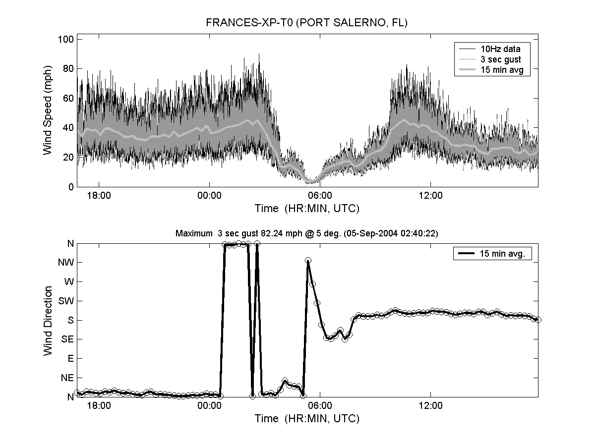
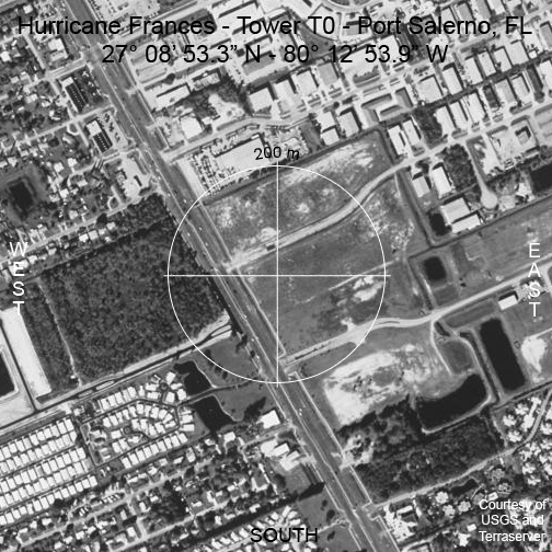
| T0 | Port Salerno, FL | 27° 08′ 53.3″ N 80° 12′ 53.9″ W |
|
 |
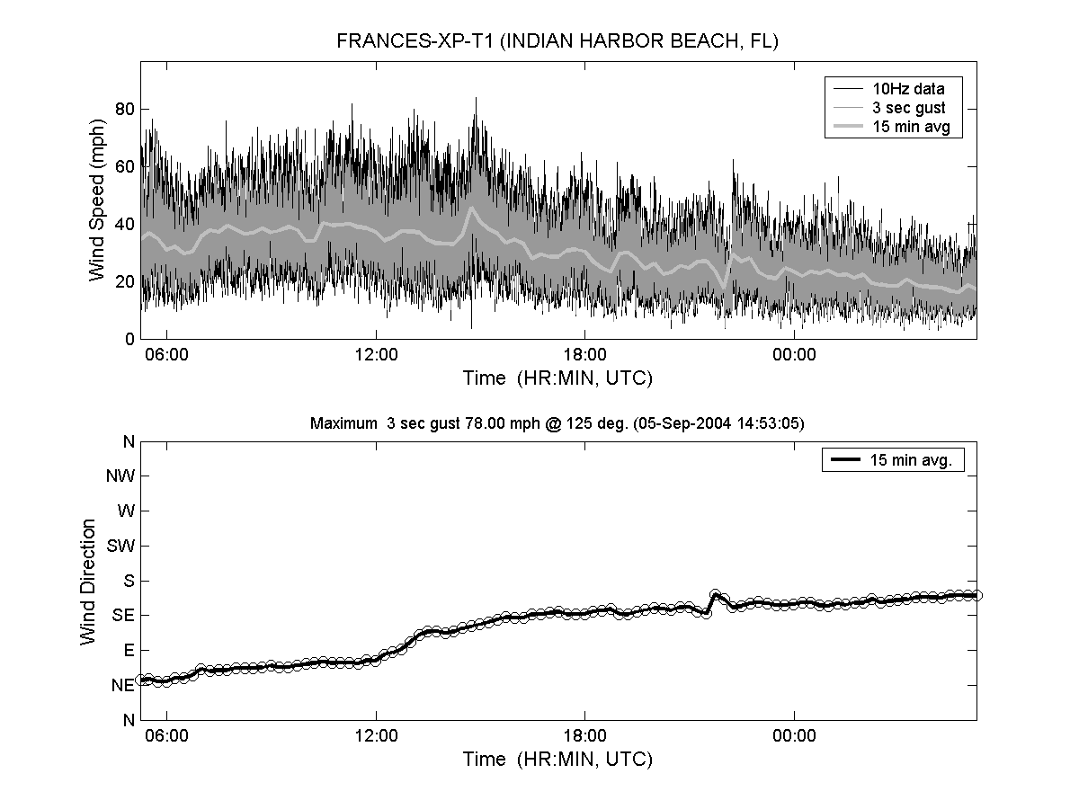
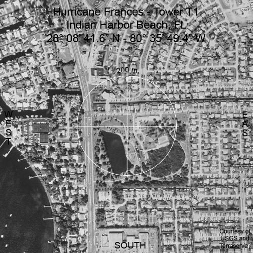
| T1 | Indian Harbor Beach, FL | 28° 08′ 41.6″ N 80° 35′ 49.4″ W |
|
 |
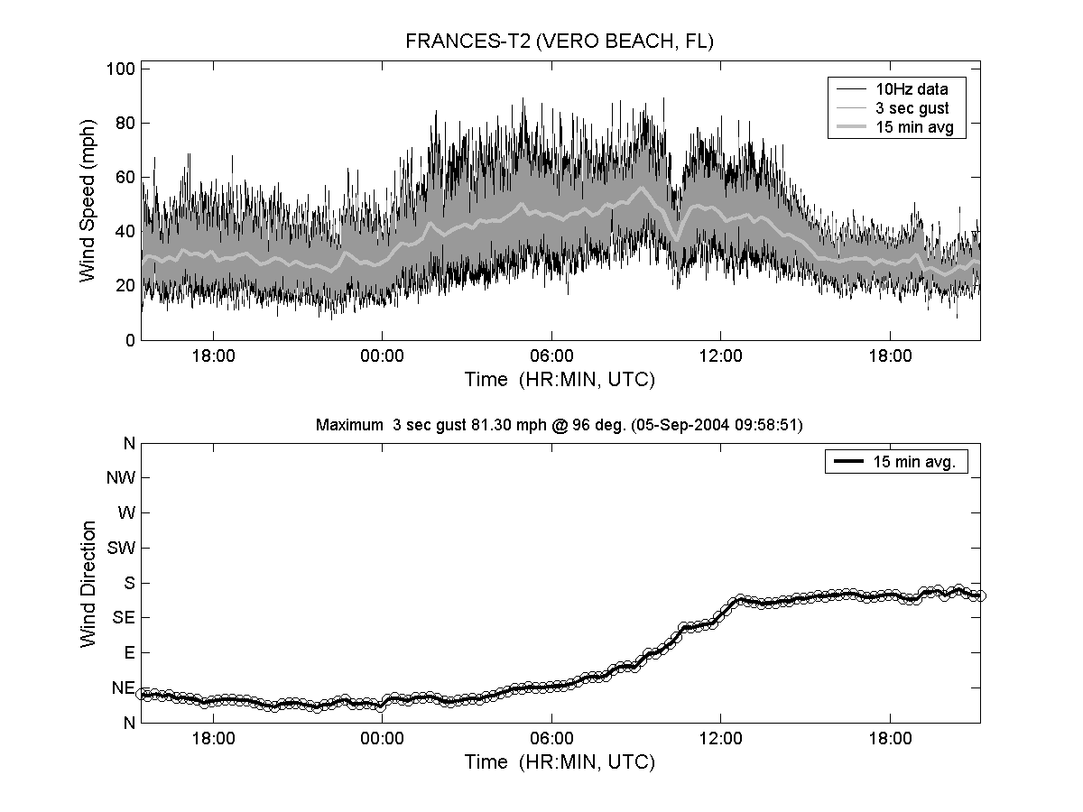
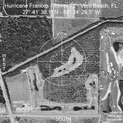
| T2 | Vero Beach, FL | 27° 41′ 38.1″ N 80° 24′ 29.5″ W |
|
 |
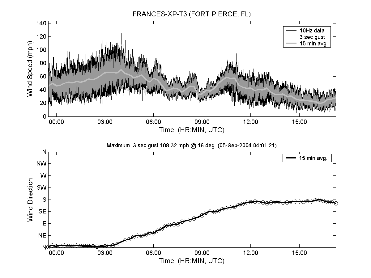
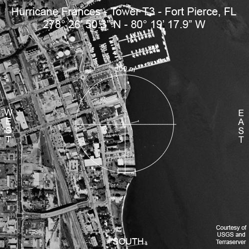
| T3 | Fort Pierce, FL | 27° 26′ 50.3″ N 80° 19′ 17.9″ W |
|
 |
| Tower | City, State | Maximum Wind Speed On Site (1 Minute Avg) | Maximum Wind Speed On Site (3-Sec Gust) |
|---|---|---|---|
| T0 | Port Salerno, FL | 57.33 mph @ 358 deg. | 82.23 mph @ 5 deg. |
| T1 | Indian Harbor Beach, FL | 72.21 mph @ 252 deg. | 83.02 mph @ 227 deg. |
| T2 | Vero Beach, FL | 64.02 mph @ 76 deg. | 81.29 mph @ 96 deg. |
| T3 | Fort Pierce, FL | 81.00 mph @ 17 deg. | 108.32 mph @ 16 deg. |