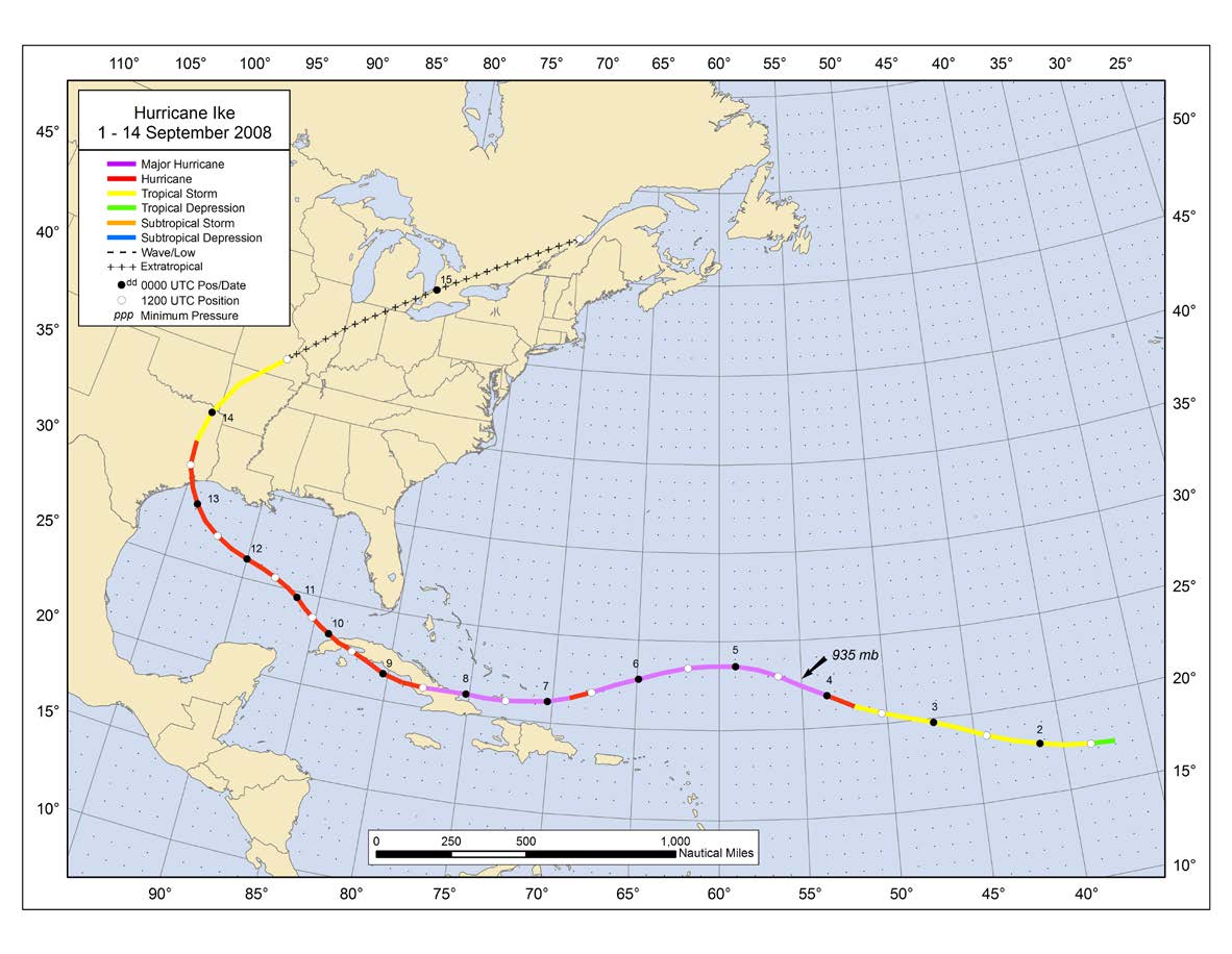
Storm Track
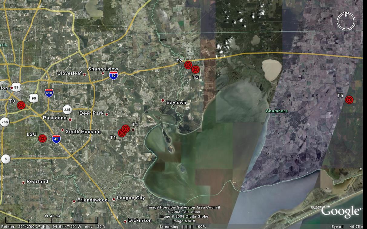
| Tower: | Location: | GPS Coordinates | Realtime Data: |
|---|---|---|---|
| T0 | University of Houston, Riverside Terrace, TX | 29.720011° N 95.3371490° W | Data |
| T1 | La Porte Park, Southeast Harris Division, TX | 29.657754° N 95.072729° W | Data |
| T2 | St. Hwy 146, Eldon, TX | 29.811969° N 94.901578° W | Data |
| T3 | Wallace Road, Cedar Bayou Area, TX | 29.801944° N 94.882221° W | Data |
| T4 | La Porte Municipal Airport, Southeast Harris Division, TX | 29.667200° N 95.063730° W | Data |
| T5 | Fairview Road, Winnie-Stowell Division, TX | 29.732537° N 94.481303° W | Data |
Deployment Map