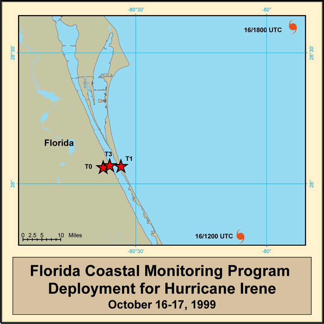
Hurricane Irene Deployment Map
Tower Data Records – Hurricane Irene
| Tower FTP #1 | City, State | GPS Coordinates | Aerial Photo | Summary Plots | Notes |
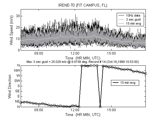
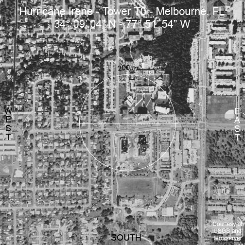
| T0 | Melbourne, FL | 34° 09′ 04.0″ N 77° 51′ 54.0″ W |
|
 |
|
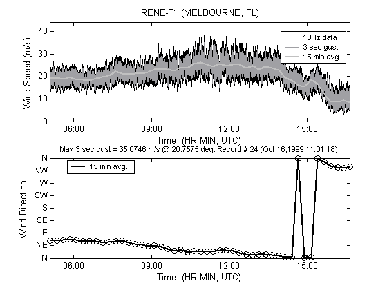
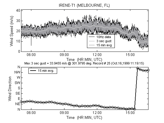
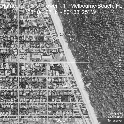
| T1 | Melbourne Beach, FL | 28° 04′ 07.0″ N 80° 33′ 25.0″ W |
|
 |
|
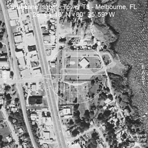
| T3 | Melbourne, FL | 28° 04′ 18.0″ N 80° 35′ 59.0″ W |
|
 |
| Tower FTP #1 | City, State | Maximum Wind Speed On Site (1 Minute Avg) | Maximum Wind Speed On Site (3-Sec Gust) |
|---|---|---|---|
| T0 | Melbourne, FL | 38.19 mph @ 7 deg. | 58.52 mph @ 9 deg. |
| T1 | Melbourne Beach, FL | 68.77 mph @ 23 deg. | 79.37 mph @ 21 deg. |
| T3 | Melbourne, FL |