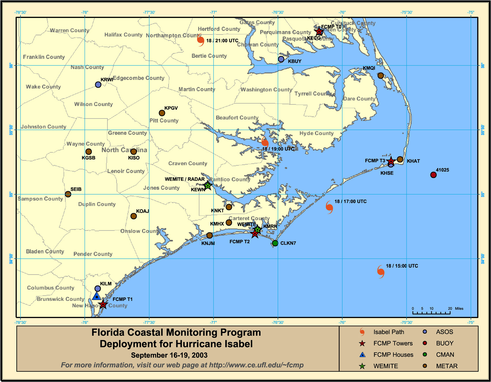
Hurricane Isabel Deployment Map
Tower Data Records- Hurricane Isabel
| Tower FTP #1 | City, State | GPS Coordinates | Aerial Photo | Summary Plots |
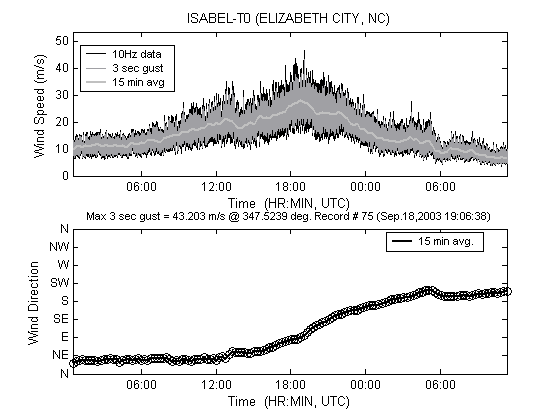
| T0 | Elizabeth City, NC | 36° 16′ 03.0″ N 76° 10′ 51.0″ W |
|
 |
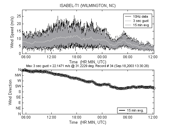
| T1 | Wilmington, NC | 34° 08′ 57.0″ N 77° 51′ 34.0″ W |
|
 |
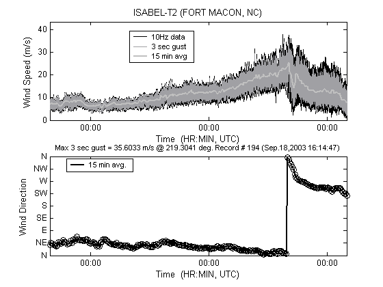
| T2 | Atlantic Beach, NC | 34° 41′ 54.0″ N 76° 40′ 45.0″ W |
|
 |
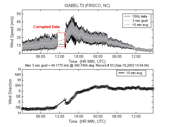
| T3 | Frisco, NC | 35° 13′ 53.0″ N 75° 37′ 15.0″ W |
|
 |
| Tower FTP #1 | City, State | Maximum Wind Speed On Site (1 Minute Avg) | Maximum Wind Speed On Site (3-Sec Gust) |
|---|---|---|---|
| T0 | Elizabeth City, NC | 74.18 mph @ 90 deg. | 97.26 mph @ 85 deg. |
| T1 | Wilmington, NC | 34.47 mph @ 324 deg. | 49.48 mph @ 280 deg. |
| T2 | Atlantic Beach, NC | 63.91 mph @ 343 deg. | 77.15 mph @ 349 deg. |
| T3 | Frisco, NC | 81.07 mph @ 123 deg. | 100.93 mph @ 121 deg. |