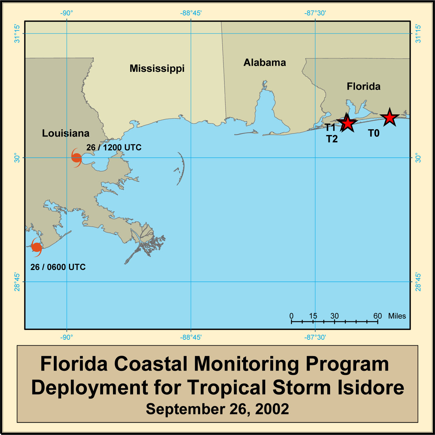
Hurricane Isidore Deployment Map
Tower Data Records- Hurricane Isidore
| Tower FTP #1 | City, State | GPS Coordinates | Aerial Photo | Summary Plots | Notes |
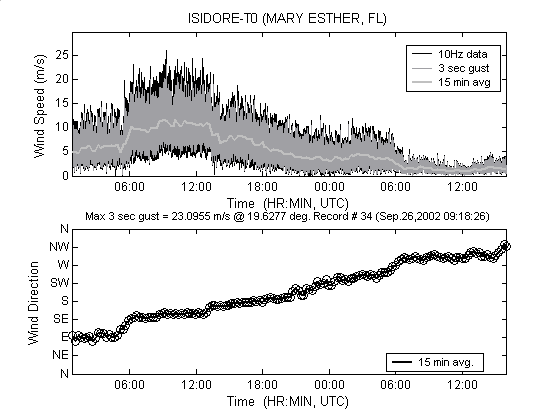
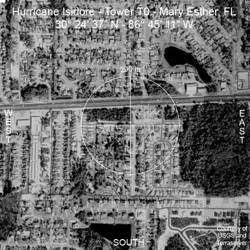
| T0 | Mary Esther, FL | 30° 24′ 37.0″ N 86° 45′ 11.0″ W |
|
 |
|
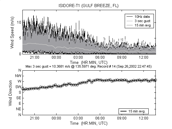
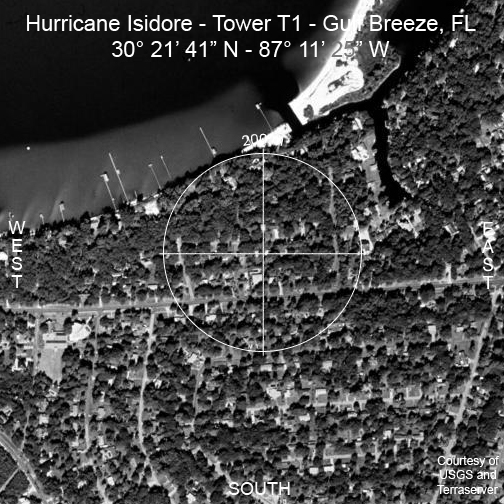
| T1 | Gulf Breeze, FL | 30° 21′ 41.0″ N 87° 11′ 25.0″ W |
|
 |
|
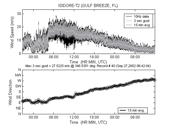
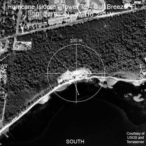
| T2 | Gulf Breeze, FL | 30° 21′ 08.0″ N 87° 10′ 25.0″ W |
|
 |
| Tower FTP #1 | City, State | Maximum Wind Speed On Site (1 Minute Avg) | Maximum Wind Speed On Site (3-Sec Gust) |
|---|---|---|---|
| T0 | Mary Esther, FL | 34.56 mph @ 150 deg. | 52.01 mph @ 145 deg. |
| T1 | Gulf Breeze, FL | 11.41 mph @ 208 deg. | 22.86 mph @ 200 deg. |
| T2 | Gulf Breeze, FL | 50.02 mph @ 130 deg. | 60.60 mph @ 123 deg. |